发表期刊:International Journal of Environmental Research and Public Health
分区:SCI三区
影响因子:4.614
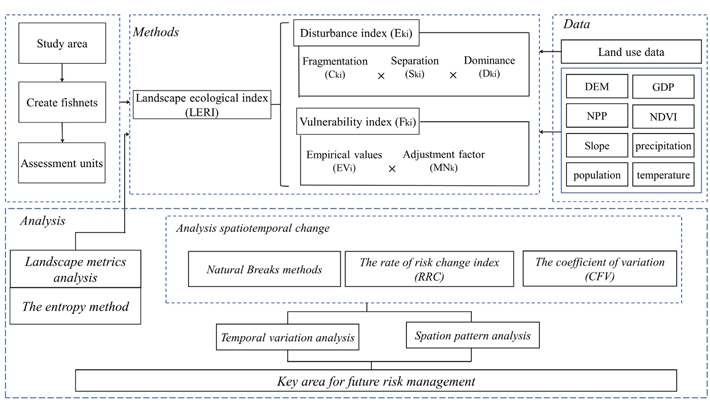
Intense human activities have led to profound changes in landscape patterns and ecological processes, generating certain ecological risks that seriously threaten human wellbeing. Ecological risk assessment from a landscape perspective has become an important tool for macroecosystem landscape management. This research improves the framework and indices of the ecological risk assessment from a landscape perspective, evaluates the land use pattern and landscape ecological risk dynamics in the Yellow River Ecological Economic Belt (YREEB), analyzes the spatiotemporal variation, and identifies key areas for ecological risk management. The results indicate the following: The main land use types in the region are grassland and cropland, but the area of cropland and grassland decreased during the study period, and with the accelerated urbanization, urban land is the only land use type that continued to increase over the 20-year period. The ecological risk in the YREEB tended to decrease, the area of low ecological risk zones increased, while the area of high ecological risk zones gradually decreased. Most areas are at medium risk level, but the risk in central Qinghai and Gansu is obviously higher, and there is a dispersed distribution of local high- and low-risk zones. A total of 37.7% of the study area is identified as critical area for future risk management, and the potential for increased risk in these areas is high. These results can provide a basis for sustainable development and planning of the landscape and the construction of ecological civilization in ecologically fragile areas.